

Fu Shan Viewing Point
Tai O, Lantau Island
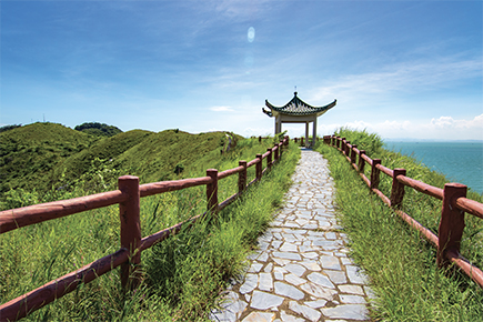
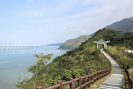
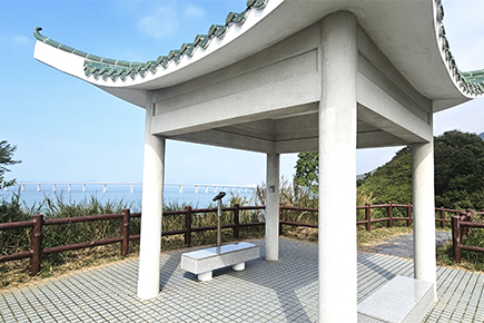
Fu Shan is situated to the west of Tai O at about 77 metres above sea level. Visitors can reach the Fu Shan Viewing Point via a 20-minutes walk along the Tai O Country Trail, where red railings and dolphin sculptures along the way are popular photo spots. Visitors can enjoy the panoramic view of Tai O and admire the sunset scenery from the viewing point. On clear days, the Hong Kong-Zhuhai-Macao Bridge can also be glimpsed in the distance. The viewing point is an ideal spot to take in the natural scenery and sea view of Tai O, and is particularly popular with families and photography enthusiasts.

Transportation options

From other parts of Lantau Island 🡪 Tai O (New Lantao Bus)
Route No. 1
From Mui Wo to Tai O: Alight at Tai O Bus Terminus.
(Approximately an hour ride)
Route No. 11
From Tung Chung to Tai O: Alight at Tai O Bus Terminus.
(Approximately a 65-minuts ride)
Route No. 21
From Ngong Ping to Tai O: Alight at Tai O Bus Terminus.
(Approximately a 20-minutes ride)

Tuen Mun 🡪 Tung Chung 🡪 Sha Lo Wan 🡪 Tai O (Fortune Ferry)
Ferry
From Tuen Mun to Tai O: Disembark at Tai O Public Pier, passing through Tung Chung and Sha Lo Wan.
(Journey time: approximately 87 minutes for ordinary ferries and 55 minutes for fast ferries)
If you are planning to visit the Fu Shan Viewing Point, you may refer to the Transport Department’s “ HKeMobility ” and the Lands Department’s “ Geoinfo Map ”, or click the Amap and Google Maps links below.